No shame to admit it. I DNF’d on my Manali – Leh – Khardung La Bicycling Expedition. “What’s DNF” you ask? “Did Not Finish” as commonly used in endurance sports terminology. But did I enjoy it? Of course, I did! I mean, I didn’t enjoy DNF’ing, but I thoroughly enjoyed the trip. This is my memoir of that trip.

It had been a couple of months since I quit my job. In that time, I had been on a jungle holiday to Jim Corbett to detox and to rediscover my love for wildlife photography; been on a touristic trip to Jaipur that also doubled up as a test drive of my former company’s Mercedes EQB350 EV on a long drive; and been on a trekking holiday to the Valley of Flowers / Hemkund Sahib. Oh yeah, I was going with full gusto to not waste the opportunity while I waited for the elusive head hunters to hunt me down. Once back from the Valley of Flowers, I was already itching for my next adventure. It was now more that 400 days since my last SCUBA dive, and that was an option. But then, having relocated to Delhi earlier this year, the mountains were beckoning. I had already done the Everest Basecamp trek last year. So what now?
I don’t recall where I first heard of the Manali – Khardung La cycling expedition, but that started to take my fancy. By coincidence, during a visit to my parents, I met a relation who was complaining about her crazy (really?) husband who was scheduled for the Tour of the Nilgiris this year, and had done the Khardung La ride last year. That clinched it! I started to research adventure tour companies that organized this trip. The first site that Google landed me on was Bikat Adventures and I registered without overthinking it. This was already end-August and I wanted at least a month to build up my cycling fitness for the ride. And so, end-September it was!
The next decision was regarding the bike. On speaking to the organizers, it was clear that the road was cobbled in many sections and a road bike wasn’t a good idea. And then of course, you have the endless climbs that average 4~5% (with much steeper sections in between) and I was just the average Joe at 54 years of age, and had no intentions of attempting to ape Tadej Pogacar. So either I needed to modify my road bike with a larger cassette and wider tires, which didn’t seem very practical; or I needed to buy myself a mountain bike, which I didn’t want to do; or I could rent a mountain bike from Bikat in Manali. I guess the choice was clear… I went ahead with the renting option.
That decision made, I started to focus on training for the trip and preparing my kit. I stopped running (to avoid injury), and focused more on cycling and strength workouts (and some swimming). While I did some threshold and high intensity interval work, I spent more time on Zwift doing long Easy rides for 2 or 3 hours, and doing climbs like Alpe du Zwift. I tapered off the work a few days before the ride.
Finally, the day came for me to leave home. I had packed a 120L duffel bag with all kinds of stuff. This was my first trip of this kind and since we were to have a support vehicle carrying our bags, I decided to be a bit generous with my packing. That bag ended up weighing about 25Kg! Lugging that in the Delhi Metro from Gurgaon on the Airport Express Line and then shifting to the Yellow Line to get to Kashmere Gate nearly killed me. I silently gave my gratitude to the Metro security lady, who was zapped looking at the content of the bag on her X-Ray baggage scanner, for allowing me through.
I took an overnight bus from Delhi to Manali to get there 2 days before the ride was to start. Coming from the plains, living at about 200m elevation, I really needed time to acclimatize. I was and am still convinced that the itinerary followed by Bikat (and all other adventure tour organizers) is flawed. The ride takes you to heady elevations already in the early days. This goes against all advice related to avoiding Acute Mountain Sickness (AMS). So spending a couple of days in Manali at about 2000m was the least I could do from my end. On the first day I trekked up and back 7KM each way near my hotel, gaining an elevation of 500m and reaching 2400m, on the route that takes one to Hamta Pass. That felt good. The second day, I rode around on the rented mountain bike, getting used to it and getting in some short climbs, but not overdoing it so as to save up energy for the next day.
This expedition starts in Manali in the state of Himachal Pradesh, crosses over to the state of Ladakh and culminates in its capital city, Leh. That is a total distance of about 520KM over 10 days, with an overall elevation gain of 9820m and reaching a peak elevation of almost 5400m. By the end of Day 1, you are already above 3000m and you never get below that elevation the rest of the expedition. By Day 4, you are above 4000m and you stay above that elevation until Day 9. And all along, there are no acclimatization or rest days. Compare that with the EBC Trek where on Day 2 you cross 3000m and take an acclimatization day, and on Day 5 you cross 4000m and again take another acclimatization day. As I understand, these acclimatization days are mandated by the Nepal authorities for the safety of the trekkers. I sure would have liked the relevant Indian authorities to also mandate such safety days for all high altitude adventures.
On a side note: The Tour de France riders of 2024 covered 3492KM with a total elevation gain of 52,230m over 21 days. Just wow!
And if you are reading this post wondering if this ride is for you, my guidance is to treat this as a difficult ride. If you are an experienced endurance rider whose idea of weekend fun is to go out and do a 70~100KM ride that includes climbs, this is probably for you. If that isn’t you, it’s probably a good idea to get into that bad habit first 😊. On the other hand, you certainly don’t need to be the competitive riding type. This ride is meant to be fun and there is no need to rush. There’s lots of time to take regular breaks and enjoy the scenery, and to generally treat this as a sightseeing tour. And taking it easy keeps AMS away. But then, there are all these Strava segments all along, and if you are a KOM seeker, go for it, but first, please acclimatize well.
Anyway, that’s enough of a preamble. Let’s get down to the ride experience itself.
The Ride Experience
| Day 1 | Manali (1880m) to Marhi (3250m) | ||
| Distance: | 39KM | Time (Moving | Total): | 5:00 | 7:00 hrs |
| Elevation (Min | Max | Gain): | 1880 | 3250 | 1445m | ||
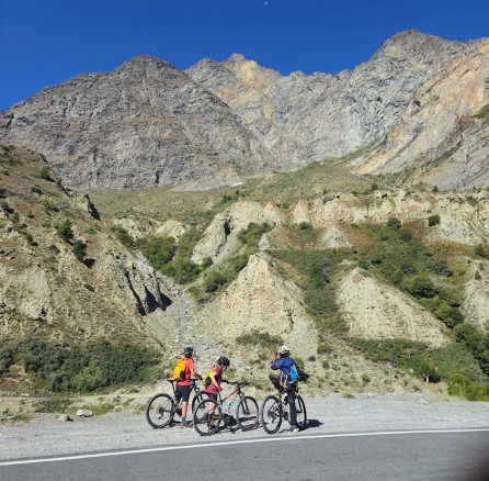
22nd Sept 2024. We had agreed with the trek leader to start at 8 AM. We were only 3 riders on this trip. I met my fellow riders, Mrs. & Mr. B, in our hotel’s restaurant and was pleased to know that they were also not that chronologically young. I didn’t want to be stressed trying to keep up with a bunch of young speedsters. I got to know them better over the next few days, and they turned out to be a lovely couple. What surprised me was that at 59 and 66 years of age, they were absolutely fit and tackled the rides with aplomb. Being residents of Boulder, Colorado, staying at an elevation of 1700m, and being avid bikepackers probably helps. Mr. B had also gone through a major spinal surgery less than a year ago, and his was a remarkable turnaround.
8AM, and we are awaiting the trek leader. Neither the B’s nor I were surprised that there was no sign of the trek leader and the support vehicle. At 8.30AM, we decided to set out on our own. The support vehicle eventually caught up with us at 12.30PM. I’m glad we didn’t wait, but was also quite sad for how we Indians value punctuality. I was reminded of how appreciative our Sherpa was during my EBC trek last year. Of all the Indian groups he had led over the years, ours was one of the few that was always ready on time, each morning.

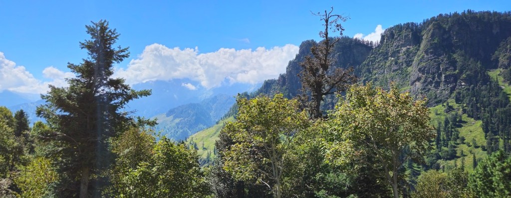
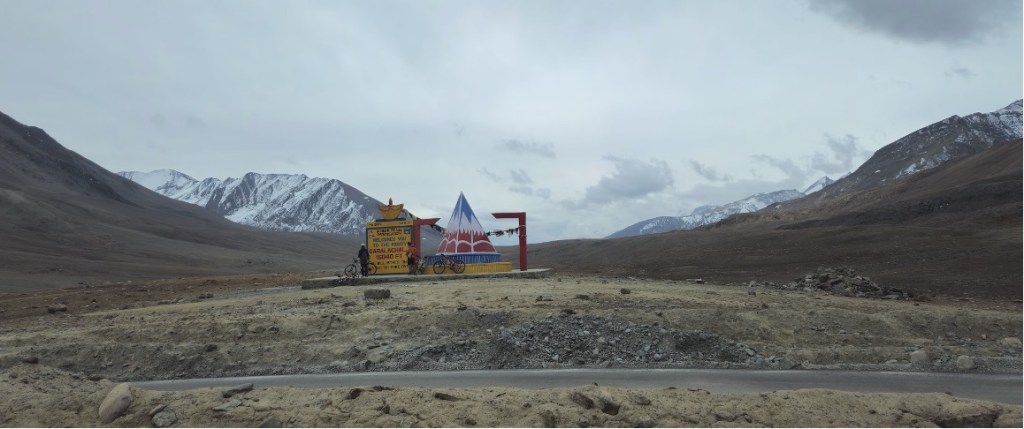
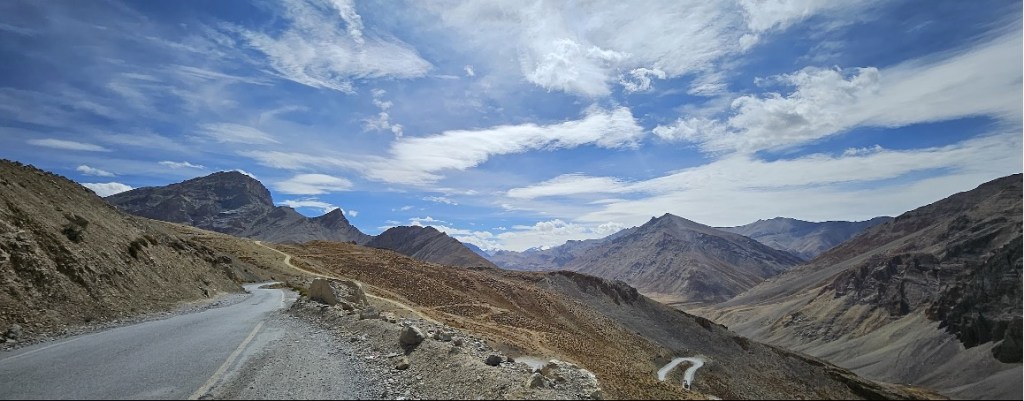
The ride from Manali to Marhi was quite nice, but is a continuous ascent all the way with an average gradient of 4%, peaking at about 8%. Setting off from Manali, you ride along the Beas river with its beautiful backdrop of mountains. You cross India’s highest Starbucks at about 2200m elevation. After riding about 13KM on the 2-lane Manali-Leh highway, we diverted onto the old route that leads to Rohtang Pass. Beyond this point, there wasn’t much by way of habitation. This is a rather narrow 1-lane road that isn’t very well maintained since the Atal Tunnel opened up and bypassed this route, and has a lot of tourist traffic headed for Rohtang Pass, kicking up dust and not necessarily giving bikers space. All around we had tree lining until about the 25KM point where we stopped for lunch. Beyond that (about 2800m), the tree lining thinned out and we had some beautiful valley and mountain views, including that of the snowcapped Hanuman Tibba, to keep us enchanted. As we approached Marhi, we could also see several para-gliders and vultures circling above us.
Marhi is just an open space in the mountain with a couple of coffee shops, a stream, some wandering shepherds with their cattle and dogs, and then of course a bunch of vultures. I learnt later that Marhi also hosted the Paragliding World Cup just a month later. We set up camp in the middle of a space that had cow dung everywhere you looked. This was my first experience with outdoor camping. A couple of friendly shepherd dogs settled in the shade behind my tent. I had the tent to myself since we were an odd number of trekkers, which was good because I needed that space to handle my 120L duffel bag! The B’s shared a tent, and being experienced trekkers, each had something like a 40L backpack, the contents of which had already been through a month of European holiday! I never learnt to pack light. Amazing what experience can teach you. We woke up to a beautiful sunrise view, and to the spectacle of not less that 20 Himalayan Vultures perched on the flats near my tent.
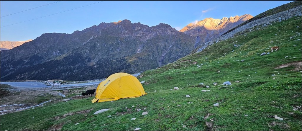

This outdoor camping experience, and especially the toilet arrangement was a new experience for me. For the toilet, the staff dug up a 2 foot deep hole in the ground, and put up a tent around it. You do your job in that hole, squatting on the ground, leave your toilet paper in the hole and cover up your job with a layer of some loose mud for the sanity of the next person. Once the campsite is done with, the staff fill up the hole and leave it to naturally decompose. Overall very workable, though squatting on the ground after a 5 hour riding day is not very forgiving on the knees. I wished they had a portable toilet seat. There was a separate tent for dining, and another one for their kitchen. Overall, a good setup. For the B’s, who normally do their own camp and cooking setup during their bike packing expeditions, this was luxury. As for me, I didn’t really sleep too well. Around 11 PM, a bunch of locals arrived on the scene and had a raucous conference about a pipe that ruptured near our camp that seemed to have cut off water supply to their accommodations. Being a light sleeper, the continuous sound from that water was already disturbance. Added to that, my tent was on a bit of a slope causing me and my sleeping bag to slide down inside the tent incessantly, and then this was the first night above 3000m and acclimatization was yet to set in. But this is what I had signed up for and didn’t complain. The morning sight of the sunrise over the mountains and that of the vultures more than made up for any discomfort. Needless to say, there was no power for recharging nor any bathing facilities at this site. My Airtel network didn’t work at the camp though it worked just a bit further away. Jio seemed to be operational.
| Day 2 | Marhi (3250m) to Sissu (3060m) via Rohtang Pass (3970m) | ||
| Distance: | 51KM | Time (Moving | Total): | 3:45 | 5:30 hrs |
| Elevation (Min | Max | Gain): | 3000 | 3970 | 815m | ||
After a hearty breakfast, we were ready to head out. From this day, the B’s and I set into a daily routine of starting out about 7:30AM, latest by 8.00AM. That meant getting out of bed about 5:30AM, morning tea about 6.00AM and breakfast around 7.00AM. The support vehicle would wrap up the camp, prepare some lunch and follow a couple of hours later. One of the crew would ride somewhere ahead of us, and had a walkie-talkie to communicate with the support vehicle in case help was needed. This also meant that we needed to be relatively self-sufficient with water and snacks as we headed out each day because we met the support vehicle infrequently. The three of us ensured that we stuck together. I had preloaded the route maps for each day, and used the navigation on my Garmin bike computer to keep us from straying. Typically Mrs. B was pacing our small group, and did a great job at keeping a meaningful pace, and planning our fueling breaks. Since we were a small group, the support vehicle also doubled up as the camp vehicle. This meant that camp was set up only after we arrived at the final destination, and the recovery nourishment was normally quite late. I solved that for myself by carrying a sports recovery mix in my camp kit.


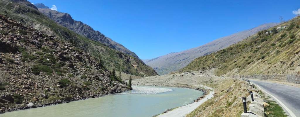
Anyway, back to D2. We were headed to Rohtang Pass and from there, onto Sissu. Marhi was just a pause on the climb that continued all the way for another 16KM / 3 hrs up to Rohtang Pass with similar valley and mountain views as the previous day. The Pass was a crowded tourist location. Tea shop tents were abuzz with activity and tourists were all over the place. The views of the snowcapped peaks around the Pass were stunning. After a short break for a cup of coffee, pictures and to recoup energy, we continued our ride. What I didn’t expect was that the views on this side were even more amazing. The next 20KM was a long steep winding downhill with excellent roads, and I wasn’t prepared for that. I was freezing. I first pulled on a light wind jacket. Then some full finger gloves. And finally a buff to cover my neck and ears. With all that, my extremities – fingers, toes and nose – were still going numb. The B’s were a lot more acclimatized to these temperatures. Near the end of the descent we stopped for a pre-packed lunch of potato chapati rolls that were also desperately cold. A couple of cups of hot Ginger Lemon Tea helped get the blood circulating again. After another 15KM of riding, where we rode past the other end of the Atal Tunnel and rode alongside the Chandra River, we reached Sissu which seemed a well inhabited small town. Here, we were put up in a so called homestay, which in reality was a small hotel. So we had our own rooms, with electricity, hot water geyser, a proper bed and a working cellphone network… pure luxury.
| Day 3 | Sissu (3060m) to Jispa (3300m) | ||
| Distance: | 50KM | Time (Moving | Total): | 3:45 | 6:00 hrs |
| Elevation (Min | Max | Gain): | 2900 | 3430 | 924m | ||

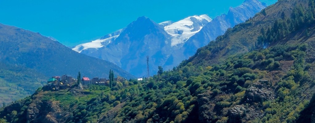
After a good night’s rest here, we headed out to Jispa. The initial stretch is largely downhill with amazing views. The landscape starts to change with a dry barren beauty about it. After about 20KM, we stopped for some tea and coffee, and then the day’s climbs started that took us through Keylong. This always get me thinking that cycling mimics life. When you have your downs, the ups eventually follow. The only difference being that the ups are fun in life, but it’s only the diehard cyclist who looks forward to the ups in cycling.
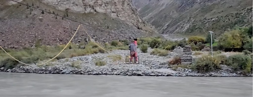
The last stretch after lunch was a bit of a strain, as always. But we reached Jispa in good time and were happy to note that this was another nice homestay on the banks of the very pretty Bhaga river. Again with access to all the amenities, we were starting to be spoiled. There were quite a few fancy homestays and swiss tents in Jispa, and it seems to be a stopover for the motorized tourists too. That evening we strolled down to the banks of the river, and were witness to the self-powered ropeway system that the locals use to cross over to their homes on the other bank. Mrs. B got to ride along with one of the village ladies.

| Day 4 | Jispa (3300m) to Zing Zing Bar (4270m) | ||
| Distance: | 38KM | Time (Moving | Total): | 4:15 | 6:00 hrs |
| Elevation (Min | Max | Gain): | 3300 | 4270 | 1160m | ||
All these days, we had been heading out at relatively easy temperatures (i.e. 13~14°C). But the next morning, we headed out at 6~7°C in the shade, and with winds. Oh, how I started to yearn for the Sun, and started to empathize with the Western world’s obsession with seeking out the Sun! Interestingly, when we crossed a local and waved out hellos, he said “So late” and I was wondering what he could have meant. Surely, not late in the day. I’m guessing late in the season. Over the next days, I started to appreciate that sentiment. Many establishments along the route were expecting to shut down by end-September because water sources were starting to freeze. The season was coming to an end.
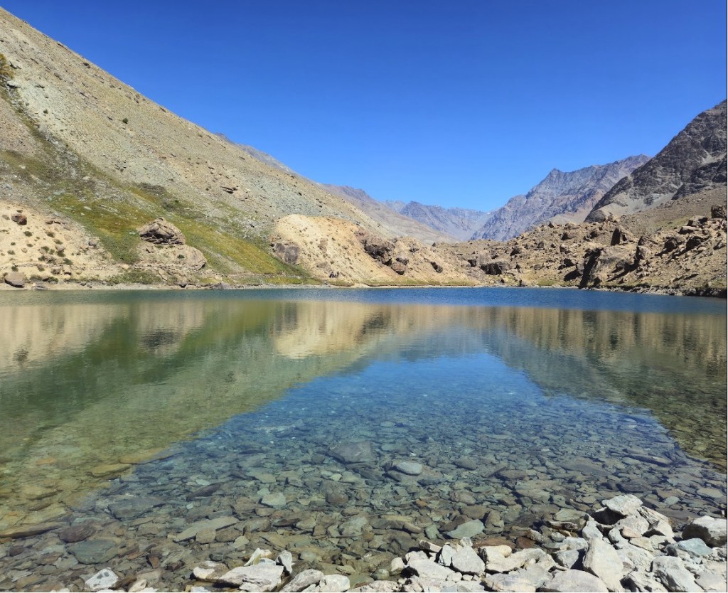

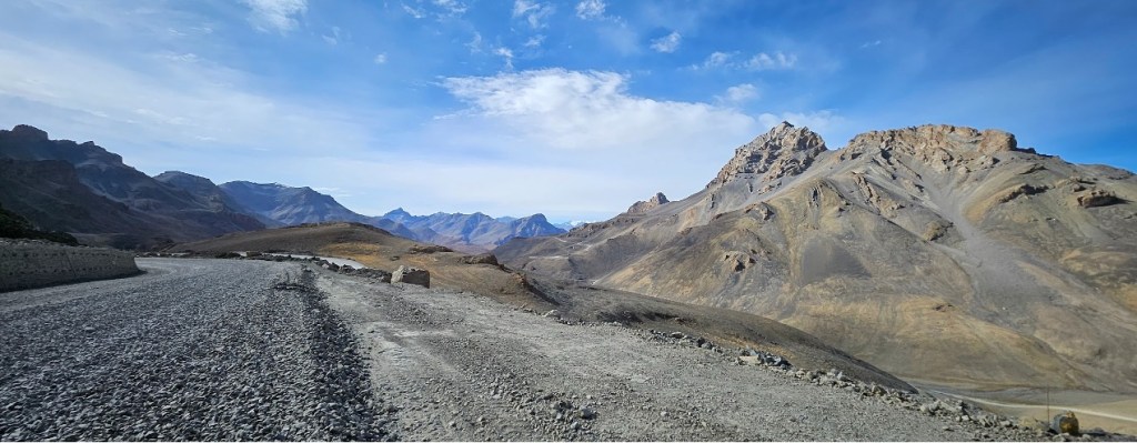
Today, the landscape started to be completely different. It was a stunning desert landscape most of the way. And climbs all along. At about the halfway point, we came upon the Deepak Tal, a small perennial man-made lake with crystal clear water set against a backdrop of the mighty mountains. We rested and snacked for a while. We then got to Lower Zing Zing Bar for a quick lunch. As usual, the climb after lunch was quite strenuous, but we reached Upper Zing Zing Bar in good time and got the first taste of what they call Dormitory accommodation. This was a large tented setup, essentially a Dhaba, with a row of beds lined on each side and a kitchen in the corner. The toilet was a cemented hole in the ground outside, with rickety tin sheets for walls and door. As we lay down in the afternoon to get some rest, a bunch of tourists dropped in for lunch. This was cooked and served in the same areas as where we were resting. The cooking fumes and a loud mother trying to force feed her child, meant that I didn’t get any shuteye. We hoped the night would be better. But as luck would have it, a bunch of motorized travelers who probably hadn’t timed their trip right, landed about 11 PM and wouldn’t stay silent. After a noisy dinner, they slept noisily, and then left early morning, again noisily. Needless to say, none of the other luxuries were available here either, including a cell phone network. That was not a good night and I really wish the organizers took the trouble of setting up camp instead of piggybacking on these poor quality dorms.
| Day 5 | Zingzingbar (4270m) to Sarchu (4370) via Baralacha La (4820m) | ||
| Distance: | 39KM | Time (Moving | Total): | 3:30 | 5:45 hrs |
| Elevation (Min | Max | Gain): | 4270 | 4820 | 616m | ||
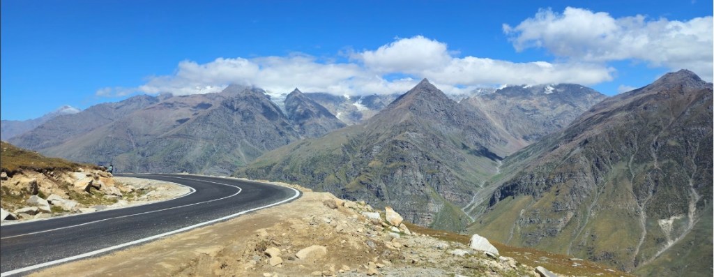
I was more than happy to get going from this accommodation. I guess I had also started to get wiser about the temperature and was better attired for it, but would never ever get comfortable with it. This day started with a continuous climb for 15KM until Baralacha Pass and then a continuous downslope for another 7KM until our lunch point, and the temperature never crept above 9°C all along! I hated that, but loved the views. The view of snowcapped mountains all around the Pass was just incredible and more beautiful than what we saw at Rohtang Pass.
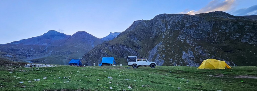
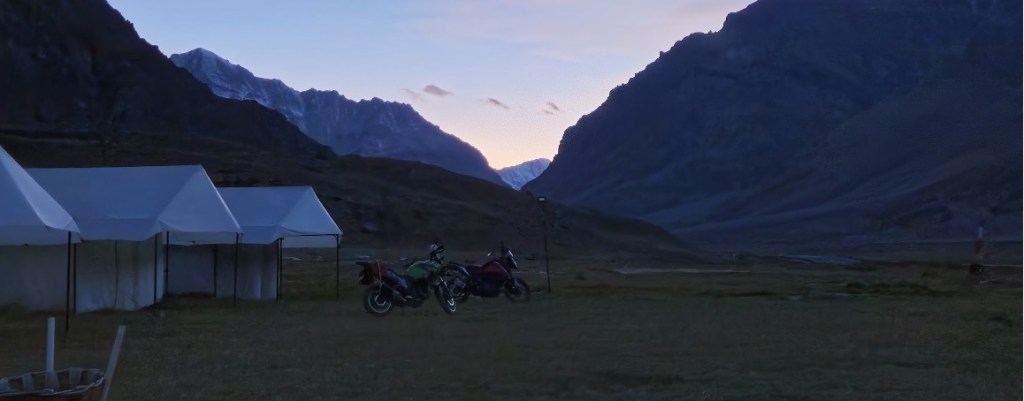
After lunch, we continued downslope and witnessed some incredible landscapes all the way to Sarchu. Accommodation in Sarchu was a pleasant surprise. We were put up in semi-permanent Swiss tents. These were large and spacious, and had a separate bath / toilet space inside with cold running water. There was a centrally located solar powered geyser from where we could get nice hot water for our bath. Another large tent had a well laid out dining space. And all this in a vast valley with beautiful views all around. There was no Airtel cell phone coverage, but a solar panel allowed charging while the sun was up. If the overall itinerary was to have a rest / acclimatization stop, this was probably the most convenient location.


| Day 6 | Sarchu (4370) to Whisky Nala (4760) via Nakee La (4750m) | ||
| Distance: | 55KM | Time (Moving | Total): | 5:15 | 8:15 hrs |
| Elevation (Min | Max | Gain): | 4180 | 4915 | 993m | ||
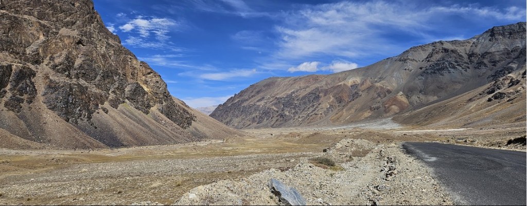
It was with a heavy heart that we left the comfy swiss tents and headed out at 2~3°C the next morning. Soon we crossed over from Himachal Pradesh to Ladakh. The landscape had now permanently changed to that of a Cold Desert… barren and dusty, but still beautiful.

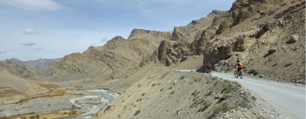
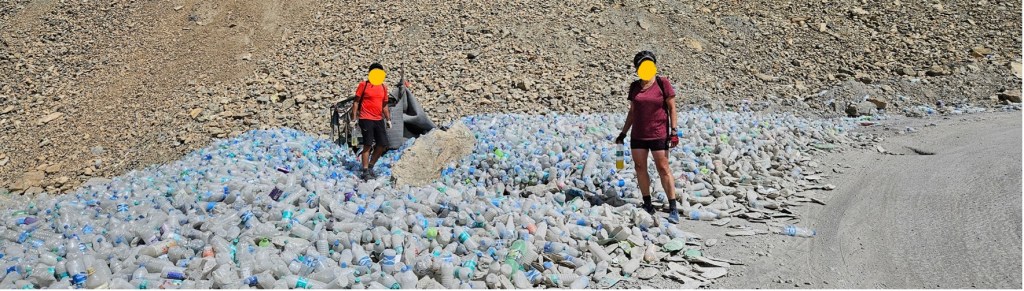
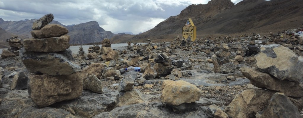
After 3 hours and 30KM of easy riding, we reached the Gata Loops. That’s a 10.5KM / 450m climb over 21 hairpin bends. Unlike most other hairpin bend sections that I have experienced, they aren’t numbered here. Mrs. B tried to keep count, but over 2.5hrs that isn’t easy, and she gave up soon enough. Somewhere along the Gata Loops there is The Ghost Temple of Gata Loops, a point where legend has it that a traveler died of thirst and his ghost haunts the area, and hence every passerby throws a mineral water bottle there to avoid bad luck. I wish people who believed in the legend would just stick to pouring a bit of water at that point, instead of littering the sensitive ecology with plastic. I generously poured out a bit of electrolyte drink 😊.
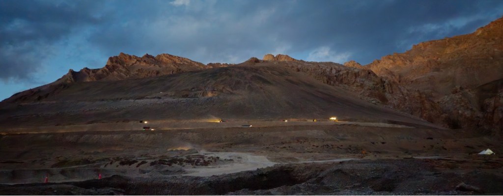
For some reason, the Gata Loops are considered a major challenge and is hyped. But that ends at only 4600m. We still had Nakee La to climb up to and then more, before a short descent to Whisky Nala. That was a tough day and we were horrified to find ourselves in another dormitory for the night. At least in this case, the sleeping arrangement was in a different tent from the kitchen and dining area. But sure enough, we had noisy bed mates who came in soon after we hit bed and left early in the morning. The toilet was a total disaster. That valley was also the site of major road construction work, so there were lorries all over the place and dust and noise. Not a happy stay!
| Day 7 | Whisky Nala (4760) to Debring (4650m) via Lachung La (5060m) | ||
| Distance: | 76KM | Time (Moving | Total): | 6:30 | 9:00 hrs |
| Elevation (Min | Max | Gain): | 4500 | 5060 | 767m | ||
The next day started directly with a climb up to Lachung La followed by a long downhill until we stopped for lunch. This entire stretch wasn’t a lot of fun because of extensive road construction. At some point the roads got better and around that same area, I started to see interesting formations that looked like large castles carved by the forces of nature into the mountain side. These structures reminded me of similar structures I had seen during the air balloon rides over Cappadocia in Turkey. Post lunch was another painful climb, but mercifully for only an hour.

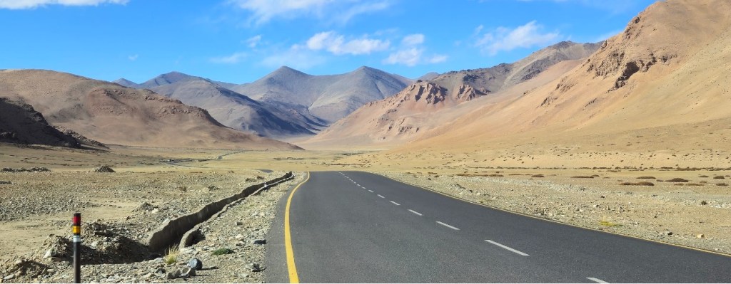
And then we reached the More Plains. This place is a landscape photographer’s dream. The long winding roads disappear over the horizon and seem to lead to nowhere. The vibrant and multi-coloured hues of the landscape, set against a blue sky was breathtaking. The “Cold Desert” was now in its full glory. We also saw several herds of Tibetan Wild Ass (a.k.a Kiang), on the plains.

This also somehow confused us regarding the remaining effort for the day. After having done about 73KM, we assumed we were almost done when our trek leader told us that we had another 12KM to go. That was it… we were completely drained and declared that we may not make it. Fortunately, he got us accommodation in another dormitory about 2KM away. To this day, we aren’t clear where we went wrong with the distance and fueling plan. This dormitory in Debring was actually not too bad. This was the residence of a Buddhist family. They had one bedroom for the dormitory and no one disturbed us that night. They had a proper western style indoor toilet too. The lady running the place was very sweet and helpful, and was always busy chanting Buddhist prayers. Overall, a good setup, and we were glad to have stopped there.
| Day 8 | Debring (4650m) to Lato (4170m) via Taglang La (5390m) | ||
| Distance: | 59KM | Time (Moving | Total): | 5:00 | 7:00 hrs |
| Elevation (Min | Max | Gain): | 4170 | 5390 | 700m | ||
The next day disaster struck, and my DNF story began. We set off like any other day. The route was a continuous climb for about 20KM to reach Taglang La. After about 3 hours of riding, I began to suffer. I had been drinking fluids, but for some reason didn’t need to pee. While my heart rate was well in control, I was starting to have a dry cough and was gasping for breath. By about 5200m elevation, it reached a point where I needed a break every 200m or so. There was only another 150m to climb, but this didn’t feel right or safe any longer. The B’s were doing fine. I decided to abort and asked for the support vehicle to pick me up and take me to the summit. Once there, and about 2L of fluids in, I finally started to be able to pee and was able to clear my insides too. That felt better. The B’s arrived about 45min later, a job well done. By then I felt good enough to join them on the remaining ride which was all downslope until we reached our destination at Lato. The views from Taglang La and all along to Lato was very pretty. As we approached Lato, the landscape started to look very different, a bit difficult to describe.


At Lato, the plan was to camp in the backyard of a very decent homestay. I was in no mood for a tent when there were perfectly good rooms with toilets, power and hot water geysers available right on that site. So we paid extra and upgraded ourselves. And then, another incident completely shook my confidence. While having a lukewarm shower, I started to gasp for breath. It was like my trachea had shut down. It took about 15min, out of the bathroom and in bed, to get my breath back under control. I also thought I heard some rasping sounds from my chest. With the cell phone network again operational, I did some reading on the net and concluded I possibly had AMS, including pulmonary edema. Many of the symptoms matched. The good thing though was that my pulse SPO2 readings were still healthy.

| Day 9 | Lato (4170m) to Leh (3550m) | ||
| Distance: | 72KM | Time (Moving | Total): | 5:00 | 7:00 hrs |
| Elevation (Min | Max | Gain): | 3250 | 4170 | 600m | ||
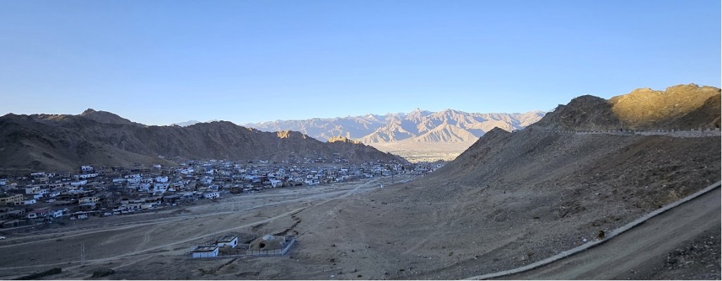
I had a decision to make. The ride to Leh didn’t sound very interesting, whereas the Day 10 Khardung La ride seemed a Must Do. I needed to sort myself before the Khardung La ride, and the nearest doctor was in Leh. So I decided to skip the ride from Lato to Leh, and take a cab instead. The homestay owner agreed to drive me over (for a price), and I visited the government hospital there. The doctor cleared me of AMS, put me on some medication for the dry cough and on a course of Diamox, and asked me to take it easy for a few days. I didn’t tell him about the Khardung La ride scheduled the next day. At Leh, we were put up in a decent hotel close to the Leh market and the Leh Palace. That was to be home for two nights.
The route from Lato to Leh is largely a downslope for the initial bit and then mainly flat, with a climb at the end in Leh. The initial stretch is nice, riding in the valleys between some beautiful mountains. As you approach Leh, there is more habitation and restaurants along the way, but also traffic. You cross some ancient monasteries and several army establishments. I’m sure I would have enjoyed the ride, but I also think it was a wise decision to use that day to rest and meet a doctor.
| Day 10 | Leh (3550m) to Khardung La (5360m) and back to Leh | ||
| Distance: | 40KM | Time (Moving | Total): | 7:00 | 9:00 hrs |
| Elevation (Min | Max | Gain): | 3550 | 5360 | 1800m | ||
Morning came, and I was ready for the Khardung La ride. We headed out early i.e. we were scheduled for a 6 AM start, but unsurprisingly headed out only at 6:30AM. Our trek leader estimated that we’d be back for lunch. On the othet hand, we had typically been averaging 30min for a 100m climb on a 4% average gradient. At that rate, my estimate was that we would reach the summit in 9 hours, and hence, this was to be a 10~11 hour day.

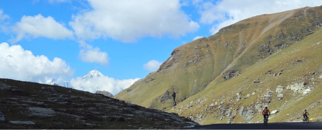
From the moment we set out, we were climbing. In fact, the steepest sections were just as we left the hotel and that wasn’t easy without having warmed up. Temperature was about 5°C, and that didn’t help either. On the initial stretch, we had some pretty views of Leh city and Buddha statues. This day is an incessant climb all the way to Khardung La, without respite. Unfortunately, the roads were also in terrible shape and we were essentially off-roading, sucking in the dust kicked up by the incessant vehicular traffic. Compared to smooth roads, these roads meant about 30% more effort. The view wasn’t changing because we were on the same face of the mountain all along. Meanwhile, my dry cough and breathlessness started to catch up with me again. After about 24KM of climbing, and more than 5 hours of riding, we reached South Pullu (4611m) and I decided to quit. My lungs didn’t feel safe anymore, and each time I tried to speak, I was caught up in a bout of coughing. Surprisingly, Mr. B also had had enough, and had been contemplating quitting. Honestly, of the 10 days of riding, while this day may be the most challenging, it was also the most boring. Bad roads, unchanging landscape, dust and traffic… overall, not so much fun.

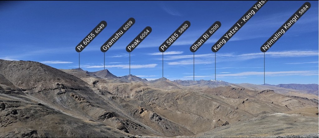
So with that decision made, all 3 bikes were loaded onto the support vehicle and we headed for the summit. The view from the Pass was beautiful as usual, with the spectacular series of mountain peaks of the Hemis National Park on one side and (I think) the Karakoram range on the other side. Photos taken, we headed back to our hotel in the support vehicle.
While heading down, I was reminded of a Brit we met on Day 5 while we had stopped for lunch. His face, with its black patchwork, had looked like he had been frostbitten. His group had signed up to be driven up to the top of Khardung La and then to bicycle down to Leh. On those roads, this is no less that a proper downhill mountain biking course, and without proper control can turn out to be quite nasty. And that is exactly what happened. He was zooming down one second and the next second, we was sprawled out on the road. Fortunately, emergency help was available at the check posts. Gist of the story… that road isn’t great!
Wrapping up
The B’s had planned on staying over in Leh for a few more days for local sightseeing. I was headed back home the next morning by flight from Leh. The bikes had been handed back to the trek crew and was to go back with them to Manali. But there was to be a twist to the tale. Ladakh went into a general strike that very day and when we returned to our hotel on D10, we were told that this was quite a strict lockdown and we were probably imprisoned in our hotel for the next 2~3 days. That evening, we clandestinely sneaked away to a 5-star hotel (because those were the only restaurants open) to celebrate the completion of the expedition. Meanwhile, the B’s changed their flight to leave the very next day. We managed to get to the airport by stealth.
The Ladakhis were protesting against Delhi for not giving them autonomy over the governance of their own state. I found this strategy entirely self-defeating. The people in Delhi don’t get hurt when Ladakh shuts down, the Ladhakis were hurting themselves. Tourists, who were their main source of income, decided to leave. I’m sure the economy took a beating. Somewhere along the way, the Gandhian philosophy of going on strike has lost its way, and forgotten how to strategically target the weak spots of those whose decision the strikers want to influence. More often than not, political strikes end up hurting their own people.
That was a wrap, or so I thought. For my flight, I had made sure to have prebooked a window seat. Something told me that the views would be worth the sacrifice of my preference for an aisle seat. And boy, was I right. The skies were clear and the panoramic views of the mountain peaks, stretching far into the horizon, was absolutely astounding… far beyond my wildest expectations. I thought to myself, there has to be a God!

What a journey it had been. Each day presented a completely different and amazing landscape… green on some days, barren open spaces with vibrant colours on other days, snowcapped mountains now and then, and river side views at other times. The clear starlit skies of Ladakh, if you are willing to bear the cold outside your tent at night, is like nothing I had ever seen before. There were several motorbike and car tourists who rode past us, but compared to them, our appreciation of the landscapes from a bicycle was priceless. The views change gradually. The same view starts to look different a bit later. And you can see it all since your views aren’t obstructed like in a car, or you aren’t zooming on a motorbike.
I would strongly recommend that this trip be on the bucket list of every endurance cycling enthusiast. Try not to time it too close to bucket kicking day, though 😊.
Unfortunately, bicycle tourism hasn’t really caught on in a big way with us Indians. We met a few Europeans and Americans along the way who were doing more ambitious trips. On Day 1, we crossed a guy who was riding from Kashmir to Manali and had almost reached his destination. He had been on his bike for 45 days, and was riding self-supported. On Day 2, we saw an Indian who was doing something similar. He was from Bangalore and said he was a climber and was looking for places to climb. I was too stunned to ask him more. The same day we saw another couple. I tracked them down on Strava flybys and found that they were from Ireland and were bike packing all over Ladakh and Himachal Pradesh for about 15 days through some crazy desolate routes. That lady picked up QOMs all along the way since she was the only female in the leaderboard!
Footnote
- A post-mortem is warranted of what happened to me on the Taglang La and Khardung La climbs, and during my shower in Lato. My guess is one of two things, or maybe a combination of both. My first suspect is AMS, even though the doctor cleared me of that. Like I said before, the altitude planning on this expedition is much more aggressive than recommended. It is just possible that I had early symptoms of AMS. The second suspect is my protection against cold and dry winds. I picked up a cough during my EBC trek too after a day of very strong cold winds, but that wasn’t as severe. Protecting against this is something I haven’t completely figured yet. Will need to check what works for me on my next trek. Also, inhaling some cold steam from a portable humidifier at the end of the day could be a backup solution.
- I have tried to focus this post on the experience of the expedition with generic details. Refer this post for more geeky details like the gear that I took along, the route and weather planning, and my altitude acclimatization stats. There is also this post where I review Bikat Adventures on this trip.

Leave a comment